
Zeit — the German newspaper — analyzed recent election results in over 80,000 regions of Europe. They discovered many patterns – from the radical left to the extremist right. Moreover, they allow you to find patterns yourself, among others in your own region.
They published the summarized election results in this beautiful interactive map of Europe.

The map is beautifully color-coded for the dominant political view (Conservative, Green, Liberal, Socialist, Far left, or Far right) per region. Moreover, you can select these views and look for regions where they received respectively many votes. Like in the below, where I opted for the Liberal view, which finds strongest support in regions of the Netherlands, France, Czechia, Romania, Denmark, Estonia, and Finland.
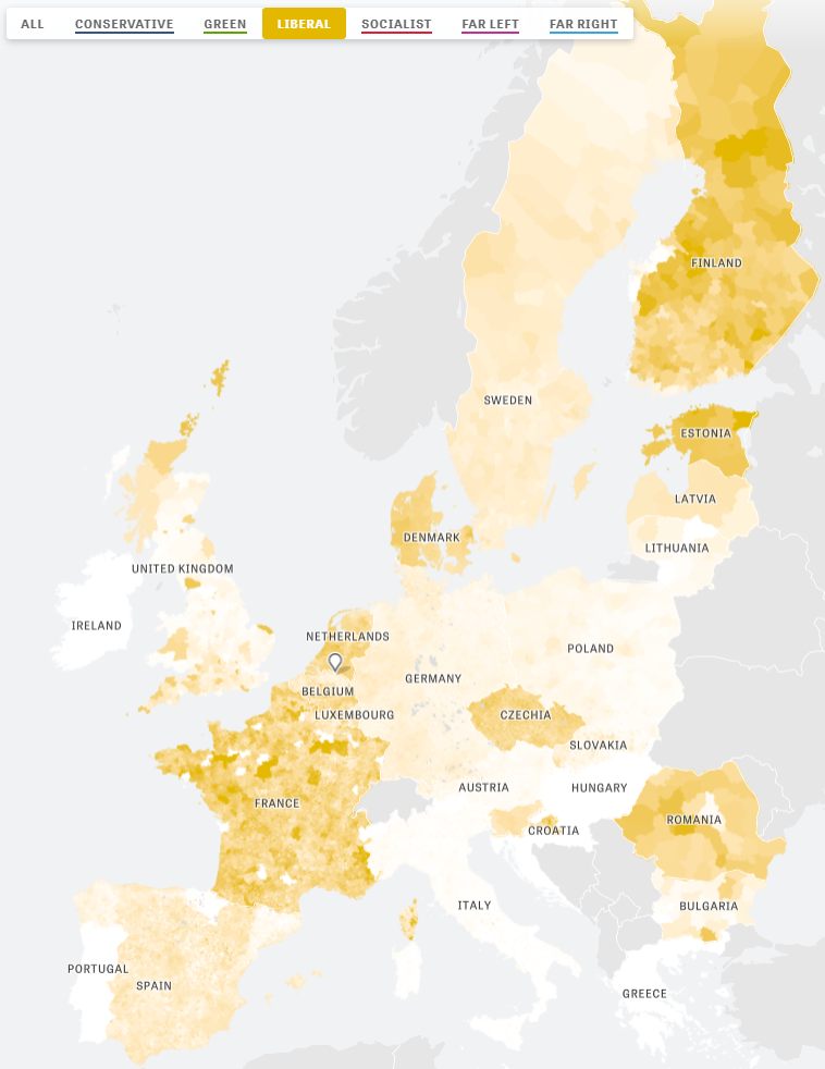
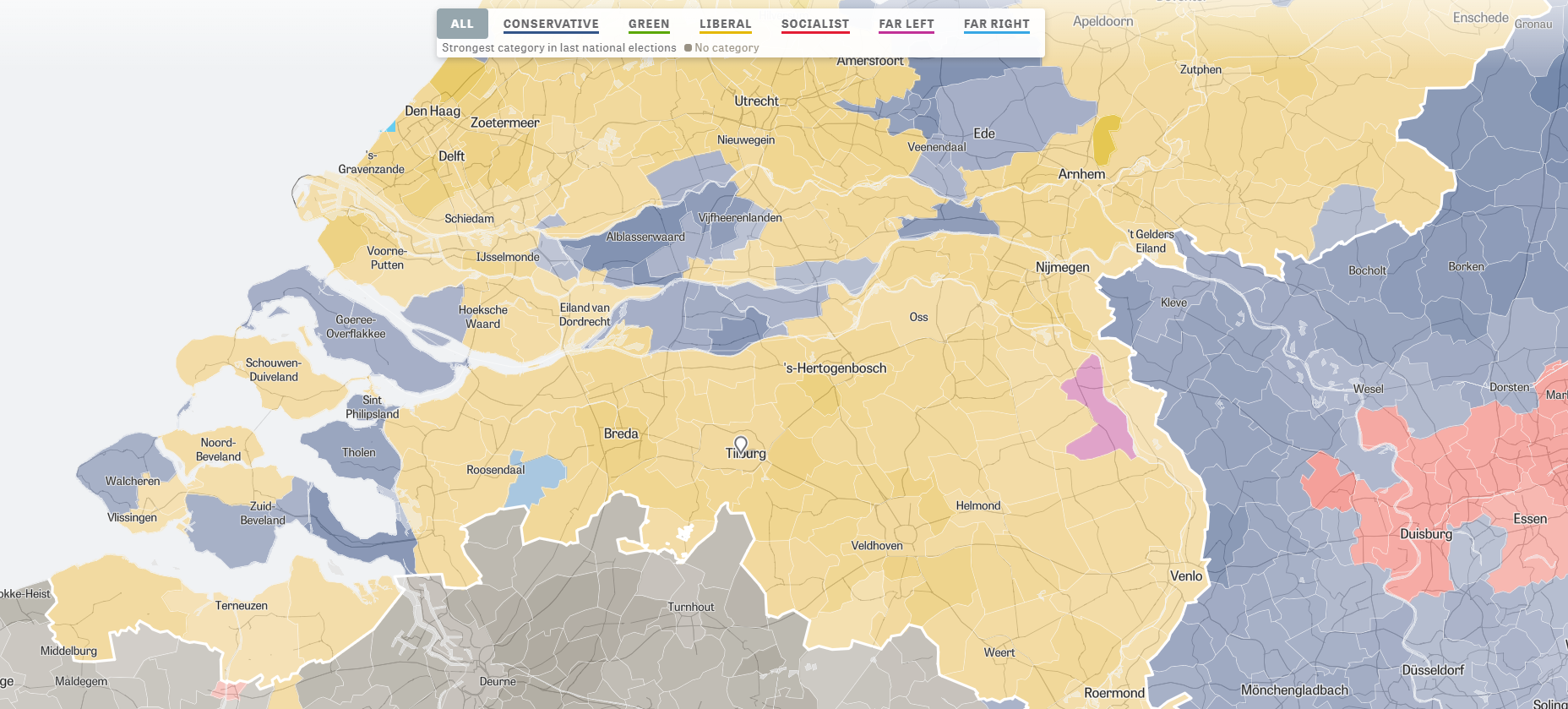
For instance, the region of Tilburg in the Netherlands — where I live — voted mostly Liberal, as depicted by the yellow Netherlands. In contrast, in the German border regions conservative and socialist parties received most votes, whereas in the Belgian border regions uncategorizable parties received most votes.
Zeit discovered some cool patterns themselves as well, as discussed in the original article. These include:
- Right-Wing Populists in Poland
- North-South divides in Italy and Spain
- Considerable support for regional parties in Catalonia, Belgium, Scotland and Italy
- Dominant Green and Liberal views in the Netherlands, France, and Germany
Have a look yourself, it’s a great example of open access data-driven journalism!
